Maps have been an integral part of human civilization, aiding in navigation and providing a visual representation of geographical data. With the advent of modern technologies, map customization has become increasingly important for various purposes such as urban planning, disaster management, and transportation logistics. In this article, we explore the concept of adding multiple overlays to maps as a means of enhancing their functionality and visual appeal.
Consider the hypothetical case study of a city’s traffic department seeking to optimize their road network based on real-time traffic data. By incorporating multiple overlays onto their existing map system, they can gain valuable insights into congestion patterns, accident-prone areas, and high-traffic zones. For instance, by overlaying historical traffic data from previous years onto the current road network layout, they can identify recurring congested areas that require infrastructure improvements or alternative routes. Furthermore, by overlaying weather information onto the map system in real-time, officials can anticipate potential disruptions caused by adverse weather conditions and implement appropriate measures accordingly.
The ability to add multiple overlays to maps provides users with limitless possibilities for customization and analysis. This article aims to delve deeper into this topic by examining different types of overlays available and discussing the benefits they offer in terms of visualizing complex spatial information effectively. Additionally, it will highlight some examples of industries and use cases where multiple overlays can be particularly beneficial, such as:
-
Urban Planning: City planners can overlay data on population density, land use, transportation networks, and environmental factors to make informed decisions about zoning regulations, infrastructure development, and urban growth.
-
Environmental Management: Overlaying maps with data on natural resources, protected areas, pollution levels, and wildlife habitats can help conservationists and policymakers identify ecologically sensitive areas and implement appropriate measures for their preservation.
-
Emergency Response: During emergencies or disasters, multiple overlays can be used to display real-time information on evacuation routes, medical facilities, emergency shelters, and potential hazards. This enables first responders to quickly assess the situation and allocate resources effectively.
-
Logistics and Supply Chain Management: By overlaying maps with information on transportation networks, warehouses, distribution centers, and customer locations, businesses can optimize their supply chain operations by identifying efficient delivery routes and minimizing transportation costs.
-
Tourism and Recreation: Tourist agencies can enhance their maps by adding overlays that highlight popular attractions, hiking trails, camping sites, restaurants, and hotels. This helps travelers plan their trips more effectively and discover new destinations.
Overall, the ability to add multiple overlays to maps empowers users to analyze complex spatial data from various perspectives simultaneously. It facilitates better decision-making across a wide range of industries by providing a comprehensive visual representation of relevant information in a user-friendly manner.
Understanding the concept of overlays
Understanding the Concept of Overlays
Imagine you are planning a road trip and need to navigate through different cities. As you look at a map, you notice various markers indicating points of interest such as restaurants, gas stations, and tourist attractions. These markers represent overlays – additional layers of information that can be added onto a base map to enhance its functionality and provide valuable insights.
Overlays play a crucial role in customizing maps to suit specific needs. They allow users to visualize data on top of existing geographical information, enabling them to make informed decisions or gain deeper understanding of certain locations. For example, imagine an online real estate platform where users can view properties for sale within their desired area. By overlaying property listings onto a map interface, potential buyers can easily see the distribution of available homes and assess their proximity to amenities like schools or shopping centers.
To better understand how overlays work, let’s explore some key characteristics:
-
Flexibility: Overlays offer flexibility by allowing users to choose which layers they want to display on a map. This customization feature ensures that individuals only see relevant information based on their specific interests or requirements.
-
Interactivity: Unlike traditional static maps, overlays enable interactivity by allowing users to interact with the displayed data. Users can click on markers or areas of interest to obtain more detailed information about a particular point on the map.
-
Contextualization: Overlays provide context by combining different types of spatial data into one comprehensive representation. Imagine a weather app that overlays current temperature conditions onto a map – this visual integration allows users to quickly identify regions experiencing extreme heat or cold.
-
Visualization: Through overlays, complex datasets can be simplified and presented visually using symbols, colors, or other graphical elements. This visualization aspect enhances user comprehension and simplifies decision-making processes.
In summary, overlays add depth and functionality to maps by incorporating additional layers of information while maintaining clarity and ease-of-use for the user.
Note: The transition into the subsequent section about “Exploring different types of overlays” can be achieved by ending the last paragraph with a sentence such as, “With an understanding of these key characteristics, let us now delve into exploring different types of overlays and their practical applications.”
Exploring different types of overlays
Understanding the concept of overlays allows for a deeper exploration into the world of map customization. By adding multiple overlays, users can enhance their maps with additional layers of information and visual elements. For instance, imagine a scenario where a travel blogger wants to create an interactive map showcasing all the destinations they have visited. They could add markers indicating each location and customize them with images or descriptions, providing a more immersive experience for their readers.
To achieve this level of customization, there are various types of overlays that can be utilized. Let’s delve into some examples:
- Markers: These allow users to pinpoint specific locations on a map by placing icons or symbols at designated coordinates. Whether it is used to highlight tourist attractions, restaurants, or points of interest, markers provide valuable context and navigation assistance.
- Polygons: With polygons, areas such as neighborhoods or regions can be visually delineated on a map using shapes connected by lines. This is particularly useful when displaying boundaries or highlighting geographical features like national parks or administrative divisions.
- Polylines: Polylines enable the creation of continuous lines connecting different points on a map. They are often employed to represent routes or trails, making it easier for users to visualize paths between locations.
- Info Windows: Info windows pop up when interacting with certain elements on a map (e.g., clicking on markers). They display relevant information about specific locations, offering additional details like addresses, phone numbers, or website links.
By incorporating these overlay options into their maps, users can elevate the user experience and capture attention effectively. To illustrate this further, consider the following table:
| Overlay Type | Use Case | Emotional Response |
|---|---|---|
| Markers | Highlighting popular landmarks | Excitement |
| Polygons | Showcasing event venues | Curiosity |
| Polylines | Mapping hiking trails | Adventure |
| Info Windows | Displaying restaurant details | Convenience |
With the ability to add multiple overlays, map customization becomes a powerful tool for engaging audiences and conveying information efficiently.
Selecting the right tools for overlay customization
Building on our exploration of different types of overlays, let’s now delve into the process of selecting the right tools for overlay customization. To illustrate this, consider a scenario where you are planning an outdoor event and want to create a map that highlights various points of interest such as food stalls, restrooms, stages, and parking areas.
When it comes to customizing maps with multiple overlays, there are several factors to consider in order to achieve your desired outcome. First and foremost is choosing the appropriate mapping platform or software that provides robust capabilities for adding overlays. Options range from Google Maps API to Leaflet.js, each offering unique features and flexibility.
To help guide your decision-making process, here are some key considerations:
-
Ease of Use: Look for a platform that offers user-friendly interfaces and intuitive controls. This will enable you to easily add, edit, and manage your overlays without requiring advanced technical skills.
-
Customization Options: Ensure that the chosen tool provides a wide array of customization options such as color schemes, icons, labels, and shapes. Having the ability to tailor these aspects according to your specific needs will enhance the visual appeal and functionality of your map.
-
Interactivity Features: Consider whether you would like your map’s overlays to be interactive elements that users can click on or hover over for additional information. Interactive maps bring a dynamic element to your project and can greatly enhance user engagement.
-
Compatibility: Assess whether the selected mapping platform integrates well with other systems or applications you may already be using. Seamless integration ensures smooth data transfer between platforms and minimizes any potential compatibility issues.
By taking these factors into account when selecting the right tool for overlay customization, you can ensure an efficient workflow while creating visually appealing and informative maps.
Now that we have established the importance of choosing suitable tools for adding multiple overlays on maps let us dive into a step-by-step guide on how to accomplish this seamlessly.
Step-by-step guide to adding multiple overlays
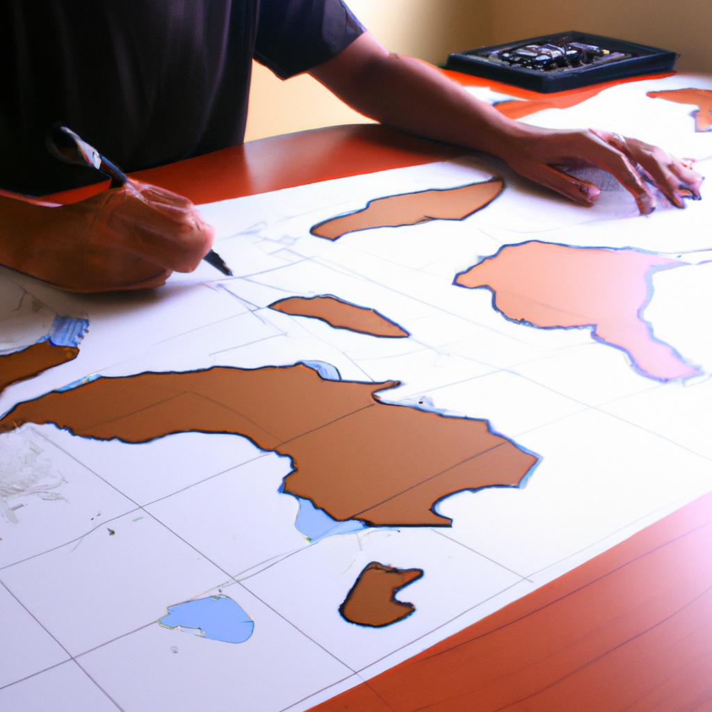
Adding multiple overlays to maps can greatly enhance their visual appeal and provide users with more detailed and comprehensive information. In this section, we will guide you through the process of adding multiple overlays step by step, ensuring that your map customization is seamless and efficient.
Imagine you are creating a map for a hiking trail in a national park. You want to include different layers of information on the map, such as points of interest (POIs), elevation contours, and vegetation types. By adding these overlays, hikers will have a better understanding of the terrain they will encounter during their journey.
To begin, it is essential to select the appropriate tools for overlay customization. Consider using software or platforms specifically designed for mapping purposes, as they often offer user-friendly interfaces and a wide range of overlay options. These tools should allow you to easily import data sources and manipulate them according to your needs.
Once you have chosen your preferred tool, follow these steps to add multiple overlays:
- Import Data: Start by importing all relevant datasets into the mapping software. This could include GIS files containing geographical features like trails and POIs, as well as image files representing vegetation types or other visual elements.
- Arrange Layers: Organize your imported datasets into separate layers based on their characteristics. For instance, place the trail dataset in one layer and the POI dataset in another layer.
- Customize Appearance: Adjust each overlay’s appearance according to your preferences. This may involve changing colors, line styles, transparency levels, or label placements.
- Order Overlays: Prioritize certain overlays over others by adjusting their stacking order within the layers panel. Ensure that important information remains visible without being obstructed by less critical elements.
By following these steps systematically, you can create visually appealing maps that effectively communicate complex information at a glance. Now let’s move on to exploring some tips and tricks for effective overlay placement while customizing maps further.
Tips and tricks for effective overlay placement will enable you to optimize the visibility and legibility of your overlays, ensuring that they enhance rather than hinder map interpretation.
Tips and tricks for effective overlay placement
Having learned the step-by-step process of adding multiple overlays to a map, let us now explore some tips and tricks for effectively placing these overlays. By following these guidelines, you can enhance your maps with ease and create visually appealing representations of spatial data.
Tips and Tricks for Effective Overlay Placement
To ensure that your overlays are placed in an optimal manner, consider the following suggestions:
-
Prioritize information hierarchy: Determine which overlay elements are most important for conveying your message or analysis. Assigning different levels of importance to various features allows viewers to quickly grasp the key aspects of the map.
-
Maintain visual balance: Pay attention to the distribution of graphical elements across your map. Avoid overcrowding certain areas while leaving other sections empty. A balanced composition helps maintain viewer engagement and prevents distractions from essential information.
-
Consider color schemes: Choose colors that complement each other and align with the overall theme or purpose of your map. Harmonious color palettes not only make your map aesthetically pleasing but also aid in conveying meaning through visual cues.
-
Use appropriate sizes and shapes: Select overlay markers, labels, lines, or polygons that appropriately represent their associated data points or regions on the map. Optimal sizing ensures clarity without overwhelming viewers with excessive detail or ambiguity.
These strategies will help guide you towards effective placement of multiple overlays on your maps, resulting in clear communication of information and engaging visualizations.
| Tips for Effective Overlay Placement | |
|---|---|
| 1 | Prioritize information hierarchy |
| 2 | Maintain visual balance |
| 3 | Consider color schemes |
| 4 | Use appropriate sizes and shapes |
Enhancing Map Visuals with Customized Overlays
Now that we have explored techniques for effective overlay placement, let us delve into ways to further enhance the visuals by customizing these overlays according to specific needs and preferences. By tailoring the appearance of your overlays, you can create maps that are not only informative but also visually captivating.
Incorporating various customization options allows for a more comprehensive representation of spatial data. In the subsequent section, we will explore different ways to modify overlay styles, adjust labeling properties, and utilize additional visual elements such as legends or scale bars. Stay tuned to discover how these enhancements can elevate the impact of your map presentations.
Enhancing map visuals with customized overlays
The effective placement of overlays on maps serves as a fundamental aspect of customizing and enhancing the visual representation. Building upon the previously discussed tips and tricks, this section delves deeper into various techniques for maximizing the impact of customized overlays. By strategically incorporating multiple overlays onto a map, users can create visually appealing representations that convey information in an engaging manner.
To illustrate the potential of multiple overlays, let’s consider a hypothetical scenario involving a travel agency. Suppose the agency wants to create an interactive map showcasing popular tourist destinations in a specific country. They decide to utilize different types of overlays to provide valuable information such as hotel locations, attractions, transportation options, and cultural landmarks. Through thoughtful placement and customization of these overlays, they aim to captivate potential travelers by offering an immersive experience that highlights key points of interest.
When adding multiple overlays to a map, it is important to keep certain considerations in mind:
- Balance: Strive for balance between different overlay elements to avoid overwhelming or cluttering the visualization.
- Hierarchy: Establish clear hierarchy among overlay components based on their importance or relevance.
- Contrast: Utilize contrasting colors or designs effectively to ensure easy differentiation between various overlay elements.
- Consistency: Maintain consistency in style across all overlays while also aligning them with the overall theme or branding.
Table 1 below provides a summary of these considerations along with their corresponding benefits:
| Consideration | Benefits |
|---|---|
| Balance | Avoids cluttered or overwhelming maps |
| Hierarchy | Emphasizes important information |
| Contrast | Facilitates easy differentiation |
| Consistency | Creates coherence and professionalism |
By adhering to these guidelines, individuals can transform plain maps into captivating visuals that effectively communicate desired information. Remember, successful customization relies not only on technical skills but also on creativity and an understanding of the target audience. By incorporating multiple overlays thoughtfully, you can create visually stunning maps that engage and inform viewers in unique ways.
Comments are closed.